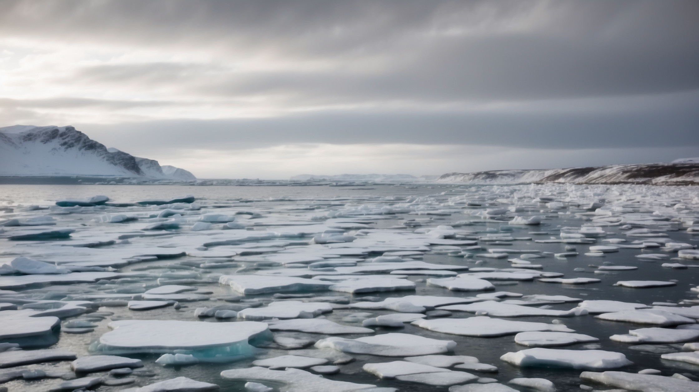
In a world increasingly destabilized by climate anomalies, meteorologists are now turning their eyes to the Arctic, where a rare and ominous event appears to be unfolding. As the rest of the Northern Hemisphere settles into what should be a relatively predictable early winter, atmospheric scientists are seeing signs of a sudden shift in upper-atmosphere dynamics that hasn’t been observed in decades. What they are calling an “early Arctic breakdown” could have far-reaching consequences—not just for Arctic regions, but for weather patterns across North America, Europe, and Asia.
Typically reserved for mid-winter or later, such disruptions in polar vortex patterns are unusual in December. Signals detected high in the atmosphere, particularly over Siberia and Northern Canada, are triggering alarms among climate researchers. Early indicators suggest we could be on the brink of a significant reversal in jet stream behavior, which in turn may lead to prolonged cold surges, unexpected snowfall, and dramatically altered storm tracks. These phenomena could affect millions across the Northern Hemisphere during the critical holiday and post-holiday runway into January.
So, what exactly is behind this looming Arctic event? What makes this year unique? And how might it impact daily lives from Berlin to Boston and beyond? Let’s break down what scientists are seeing, why it matters, and what could come next.
Key facts about the early Arctic breakdown forming in December
| Attribute | Details |
|---|---|
| Event Type | Sudden stratospheric warming and early Polar Vortex disruption |
| Timing | December 2023 – weeks earlier than usual |
| Main Indicators | Warming over Siberia, high-pressure ridge over the Arctic, shifted jet stream |
| Regions Affected | North America, Europe, parts of Asia |
| Potential Impacts | Deep cold spells, heavy snow, prolonged storms, flight delays |
| Severity | Unusually high for this time of year |
What changed this year to trigger the Arctic breakdown
Every polar vortex event starts with disruptions in the stratosphere—the layer of Earth’s atmosphere that begins about 10 kilometers above the surface. Normally, the Arctic vortex remains relatively stable, locked in place over the North Pole due to intense winter cold. But in 2023, things began to change rapidly during late November.
According to meteorologists tracking atmospheric gravity waves and upper-level temperature differentials, a sudden stratospheric warming (SSW) began developing over Siberia—nearly 6,000 kilometers away from the North Pole’s center. When air suddenly warms that high in the sky, it causes the typical circular motion of the vortex to weaken or even reverse. This in turn allows cold air to escape downward into mid-latitudes.
“The signals are stronger than anything we’ve seen since the mid-1980s,”
— Dr. Elena Rivas, Senior Atmospheric Scientist
Layering this effect was a pronounced high-pressure ridge forming over the central Arctic, which created new dynamics by forcing westerly winds to meander southward. These typically fast and straight jet streams began to kink, loop, and meander—leading to weather chaos below.
Regions most at risk due to the polar vortex disruption
The implications of this early breakdown aren’t confined to those who live north. When the polar jet stream shifts, it acts like a gate hanging off its hinges—allowing cold Arctic air to plunge far southward and warmer air to thrust north. Historically, these shifts cause some of the winter’s most severe events.
Areas of the United States including the Midwest, Northeast, and even parts of the South could experience severe cold in December, weeks ahead of normal patterns. Europe’s eastern corridor, from Poland through Southern Germany and into the Balkans, could be hit by heavy snowfalls rarely seen before New Year. Even parts of Japan and China may face unusual early freezes.
“We’re anticipating the potential for high-impact blizzards in regions unaccustomed to December snowstorms,”
— Michael Leung, European Meteorological Center Analyst
How this breakdown compares to past years
While polar vortex weakening is not in itself rare, what makes 2023 stand out is its timing. Most SSW events tend to occur between late January and February. An SSW in December is rare, and when it does occur, it’s often mild. This year’s signals suggest a disruptive force equivalent to the major breakdown in early 1985, which led to major snowstorms across North America and Europe.
| Winners | Losers |
|---|---|
| Ski resorts with early and deep snowpack | Transportation and travel industry due to delays and cancellations |
| Utility companies due to spike in usage | Municipal budgets stretched by snow removal costs |
| Winter sports businesses and retailers | Agriculture in exposed regions |
Why scientists are closely monitoring atmospheric wave patterns
Another concerning aspect of the Arctic breakdown is the role of planetary waves—large-scale undulations in the atmosphere that transfer energy and momentum upward. These are typically generated by terrain like the Himalayas or the Rockies and can act like celestial jackhammers, disturbing the stratosphere from below. When such waves intensify, the chance of stratospheric warming increases.
What we’re witnessing now, according to researchers, is a perfect storm condition: a strong planetary wave intrusion, a preconditioned stratosphere, and a receptive Arctic pattern. Early modeling now suggests sustained polar vortex weakening lasting multiple weeks—an event known to cascade weather impacts for months.
“When you add anomalous planetary wave activity to already warm Arctic temperatures, the breakdown probability goes from rare to highly probable,”
— Dr. Nadia Truong, Climate Systems Analyst
What you can expect over the coming weeks
The most immediate changes will be seen starting mid to late December. Clusters of high and low pressure will become more fixed, dramatically increasing likelihood for blocking patterns—situations where the same weather persists for extended periods. For many, this may mean lingering cold snaps, slow-moving storm systems, and weeks of challenging conditions.
A secondary risk factor emerges in sectors like aviation, shipping, and even public health. Respiratory issues tend to spike during sustained cold stretches, and elevated energy use puts pressure on power grids already strained by infrastructure setbacks and fluctuating demand. Economically, this could create a ripple effect disrupting holiday commerce and post-season travel across affected regions.
How individuals and governments can prepare
While weather cannot be controlled, its impact can be mitigated through rapid preparedness. Households in vulnerable areas should inspect heating systems, stock up on emergency food, and review transportation plans with flexibility in mind. On a municipal level, cities may need to expedite snowplow contracts, salt deliveries, and warming center protocols.
Long-term, this event could add weight to the growing list of extreme climate phenomena that reinforce the value of infrastructure investment and resilient city planning. The Arctic may be far away, but the tendrils of its instability reach much farther than we often anticipate.
Frequently Asked Questions about the Arctic breakdown
What is a sudden stratospheric warming event?
Sudden stratospheric warming (SSW) occurs when polar stratospheric temperatures spike by over 30°C within a few days. This disrupts the polar vortex and leads to changes in jet stream dynamics.
When was the last early Arctic breakdown of this magnitude?
Experts believe the last comparable early breakdown was in 1985, which preceded prolonged cold snaps and travel chaos across three continents.
Which regions are most vulnerable in December 2023?
North America (especially Northern and Eastern U.S.), much of Europe, Central and Northern Asia, and parts of East Asia are predicted to face abnormal cold and snow.
Can early Arctic instability be connected to climate change?
Many scientists believe Arctic amplification and warm temperature anomalies contribute to vortex instability, though more research is needed for direct attribution.
Will air travel be affected?
Likely, yes. Prolonged storms and frigid temperatures can lead to ground delays, cancellations, and flight re-routing.
Should people prepare differently this winter?
Yes. Earlier-than-usual storms and prolonged freezes mean people should take winter precautions now instead of waiting until January or February.
How long could the effects of this breakdown last?
Once initiated, vortex disruptions can affect weather patterns for 4–8 weeks, sometimes longer depending on reinforcing factors.
Is this considered a rare occurrence?
Yes, especially regarding the timing. December disruptions this severe are highly unusual and concerning for many in the meteorological community.