Heavy snow is poised to hit parts of the UK tonight, triggering official warnings for major disruptions, travel delays, and widespread hazards as a powerful weather system moves in from the North Atlantic. UK weather authorities have issued yellow and amber warnings across several regions, urging citizens to prepare for a significant shift in conditions just as the winter chill deepens. With snow expected to begin falling late tonight and intensify into tomorrow morning, the Met Office has advised commuters and residents to brace for markedly reduced visibility, slippery roads, and potential public transport cancellations.
The incoming storm is forecast to bring snowfall that could accumulate rapidly in some western and northern areas, particularly over higher elevations. Low-lying regions may also see snow settling for the first time this season. Emergency services are on high alert, while local councils are working to mobilize gritters and snow-clearing infrastructure. The unpredictable nature of this snow event, tied to unstable polar air masses pushing south overnight, is fuelling concerns of possible disruptions extending into the weekend.
Snow disruption overview: What to expect and where
| Category | Details |
|---|---|
| Alert Level | Yellow and Amber Warnings |
| Start Time | Late Thursday night |
| Snowfall Estimate | 5–15 cm in higher regions, 2–7 cm in lower areas |
| Primary Impact Areas | Scotland, Northern England, North Wales, Midlands |
| Expected Disruptions | Road closures, train delays, airport disruption, school closures |
| Duration | Overnight Thursday into Saturday morning |
Regions most at risk from the snow storm
The worst of the weather is expected to strike northern and western parts of the UK, including major towns and rural communities in the Scottish Highlands, Cumbria, Northumberland, and areas of North Wales. Urban centers such as Manchester, Leeds, Lancaster, and parts of Birmingham may also experience substantial snow accumulation, particularly during the Friday morning commute.
According to Met Office projections, winds from the northwest will rapidly drop temperatures below freezing, creating the perfect conditions for snow to settle on roadways and power lines. Isolated pockets in the southern counties could even see snow showers if the storm swerves slightly farther south, although sleet and freezing rain are more likely in those areas.
Who will be most affected and why preparation is key
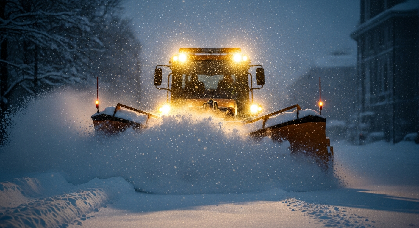
Transportation services are high on the list of concerns. Drivers are advised to avoid travel where possible, with gritters deployed to treat major arteries and rural routes overnight. Trains—especially those running in the Midlands and northern sections of the West Coast Main Line—may experience delays or be cancelled. Similarly, airports like Manchester, Liverpool John Lennon, and Glasgow International are on standby, with flight operations subject to last-minute adjustments or cancellations.
Schools in higher elevation areas have been instructed to monitor conditions closely and possibly implement remote learning protocols. Vulnerable populations, including the elderly and those with existing health conditions, have been urged to stay indoors and ensure adequate heating, food supplies, and emergency contact plans. Power outages are considered possible in areas prone to falling tree limbs and overloaded utility lines.
We’re urging everyone to take this weather seriously. The snow may not last long, but it’s expected to be intense during peak travel hours.
— Sarah McDonnell, Senior Meteorologist
How this snowfall compares to previous years
While snowfall in the UK during winter months is not unusual, the intensity and timing of this system are slightly ahead of the typical season’s snow events. Meteorologists describe this current development as part of a “displaced polar vortex” pattern—cold Arctic air being pushed unusually far south by jet stream instability. That has led to an advance in snow arrival for many parts of the country not typically affected until late December or January.
In recent memory, snowfalls of this magnitude brought similar levels of chaos, with noted examples in 2018’s Mini Beast from the East and heavy blasts in January 2021. However, what makes this instance unique is the rapid onset—forecasters only had a 48-hour lead to identify the scope of impact, suggesting an increasingly volatile atmospheric pattern as climate norms shift.
This snow system developed fast, and it shows how dynamic and unpredictable winter weather can be in today’s climate.
— Dr. Nina Hartley, Climate Systems Researcher
What precautions you should take immediately
Authorities are advising residents in affected regions to take immediate precautions. These include:
- Checking vehicle antifreeze levels and tyre treads
- Stocking up on essential groceries and water
- Keeping mobile devices fully charged in case of power loss
- Downloading travel alerts apps and following public advisories
- Ensuring pets and livestock are sheltered appropriately
The Met Office also advises checking in on elderly neighbors and relatives to ensure they have heating and necessary supplies. Strong winds linked with the front can make snow drifts worse, especially in exposed uplands, reducing time before travel routes become inaccessible. Public Health England has likewise issued reminders for proper heating, suggesting homes be kept to at least 18°C to avoid health complications related to cold exposure.
Snow storm winners and losers
| Winners | Losers |
|---|---|
| Children enjoying snow days | Commuters and travelers |
| Retailers selling winter gear and essentials | Small businesses relying on foot traffic |
| Ski resorts in Wales and Scotland | Airlines and public transport operators |
| Photographers and outdoor enthusiasts | Utility companies managing outages |
Looking ahead: when will conditions return to normal?
Forecasters expect the most intense snowfalls to subside by Saturday morning, though lingering icy patches may persist well into Sunday. Roads untreated due to staffing constraints or continuous cover may remain inaccessible. As daytime temperatures climb slightly into early next week, melt-off and slush are likely, presenting a different set of challenges such as localized flooding and slippery footpaths.
Milder, wetter systems are predicted to move in by midweek, pushing snow into higher elevations and returning lowlands to more typical damp winter conditions. Still, the rapid nature of this snow event could be a harbinger of additional bursts throughout the season, so residents are encouraged to remain prepared beyond this weekend.
One snowstorm doesn’t make a winter, but this one reminds us we must be prepared for many more surprises.
— Liam Carter, Chief Operations Officer, Mountain Rescue UK
Frequently Asked Questions (FAQs)
Which regions have the highest snow warnings?
Scotland, Northern England, North Wales, and the Midlands currently have yellow and amber alerts issued due to expected snow accumulation and blowing winds.
Will schools close during the snowstorm?
Many schools in higher elevation areas are considering closures or shifting to remote learning. Decisions are made locally by council authorities as conditions evolve.
How much snow is expected in urban areas?
Urban centers could see 2–7 cm, with higher amounts in nearby elevated suburbs or exposed zones.
Are flights and trains being affected?
Yes, delays and cancellations are expected on major rail networks and airports in affected regions. Travellers are urged to check schedules before heading out.
How long will the snow last?
The snow is predicted to persist from late Thursday through Saturday morning, tapering off as temperatures rise into early next week.
What should I do during a weather alert?
Stay indoors unless necessary, prepare an emergency kit, keep informed through alerts, and avoid risky travel during peak snowfall hours.
Can power outages occur due to snow?
Yes, heavy wet snow and falling branches may cause power disruptions, especially in rural and wooded areas.
Is this snowstorm typical for this time of year?
It’s slightly earlier and more intense than average for early winter, signaling potentially volatile weather patterns for the months ahead.