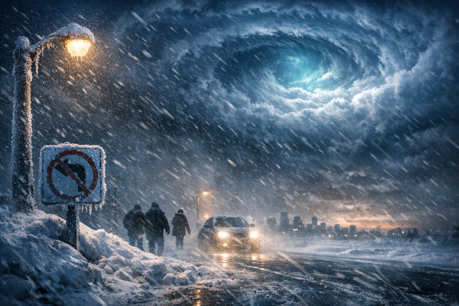
As December welcomes the peak of winter in the Northern Hemisphere, a brewing atmospheric phenomenon has caught the attention of meteorologists and climate scientists alike. A major disruption in the polar vortex appears to be developing, and early indications suggest its magnitude could be one of the most intense on record for this time of year. The surprise lies not in the disruption itself—but in its timing. Experts are stunned by the possibility of such a powerful split happening as early as December, a rarity in modern climate history.
The polar vortex is a familiar phrase to those who’ve grappled with bitter cold snaps and blizzards, especially in North America and Europe. Still, the current models hint at a possible disruption event that may surpass historical thresholds, potentially reshaping weather dynamics for weeks to come. While its typical breakdown happens later in the winter season, this early occurrence has scientists scrambling to reassess short-term weather outlooks and prepare for potential global impact.
Such events carry real-world ramifications: from frigid deep freezes in one hemisphere to unseasonable warmth in another. The early breakdown of the polar vortex could mean front-loaded winter severity this year—raising the stakes for energy providers, transportation sectors, and everyday citizens bracing for what could be a historic winter punchline. But how exactly did we get here, and what does this mean for the weeks ahead?
What changed this year
| Key Aspect | Details |
|---|---|
| Event | Potential Polar Vortex Disruption |
| Timing | Developing in early-to-mid December 2023 |
| Unusual Factor | Magnitude and early onset are almost unheard of in recent records |
| Impacted Regions | North America, Europe, parts of Asia |
| Potential Effects | Extreme cold, increased snow patterns, atmospheric blocking events |
The polar vortex is a large area of low pressure and cold air surrounding both of Earth’s poles. It’s strongest during winter, and disruptions typically happen deep into the season—often late January or February. However, in 2023, complex shifts in layers of the atmosphere, combined with already observed warming of the Arctic region and unusual tropical behavior, have conspired to shake up this pattern early.
Specifically, **high-pressure ridges** in the North Pacific and Atlantic are pressing against the stratospheric vortex. This kind of atmospheric “squeezing” can weaken the vortex or even split it in two—sending lobes of cold air careening down into populated mid-latitude regions.
How the polar vortex impacts weather conditions worldwide
The consequences of a disrupted polar vortex can be both dramatic and far-reaching. When the vortex weakens or splits, frigid Arctic air often spills southward, bringing **intensely cold outbreaks** to parts of North America, Northern and Central Europe, and East Asia. At the same time, regions closer to the poles may experience warmer anomalies due to the redistribution of atmospheric flows.
Meteorologists have already observed **snow coverage expanding rapidly** in Siberia and parts of Eurasia, possibly a response to the atmospheric distortion. Meanwhile, in North America, weather models are signaling stronger-than-usual Arctic air masses starting to build and push southward through mid-December.
The sudden polar vortex disruption in December is exceptionally rare. It raises immediate concerns not just for short-term weather but for climate trend analysis over the long term.
— Dr. Lena Hoffmann, Senior Climate Analyst
Why the December timing is significant
Historically, polar vortex disruptions of this magnitude have occurred closer to late January and February, as the deepest part of winter stresses the stratosphere. The **ongoing December split** disrupts the usual meteorological script. The energy needed to force such a split this early means we’re dealing with **unusual atmospheric dynamics**—perhaps influenced by long-term Arctic changes and persistent La Niña/El Niño cycles.
According to climate experts, an event this early can lead to consecutive cold waves through January, with only brief warmups in between. This pattern is often referred to as a “reloadable” Arctic outbreak scenario.
If the vortex collapses significantly this December, we may see back-to-back bursts of severe weather with very little recovery time in between.
— Jeff Carlisle, Lead Meteorologist
What meteorologists are tracking today
Models such as the ECMWF and GFS are currently in high agreement: the **stratospheric polar vortex** is weakening, and there’s increasing evidence of a **major displacement or even a split into two circulations**. That’s crucial because each “lobe” of the vortex then governs cold air delivery to different hemispheric zones.
The first signs will likely arrive in **Western and Central Canada**, followed by cooler air permeating the Great Lakes and Northeastern U.S., eventually reaching Europe in staggered waves. Traders in agricultural and energy markets are already adjusting positions in anticipation of demand spikes driven by cold weather.
Potential winners and losers of the vortex disruption
| Winners | Losers |
|---|---|
| Natural Gas & Heating Oil Suppliers | Energy Consumers in Northern Hemisphere |
| Retailers of Winter Gear | Transportation Industry (delays, ice storms) |
| Snow Removal Services | Outdoor Construction and Agriculture |
| Ski Resorts (with early snow influx) | Local Governments (budget strain for emergency services) |
From an economic perspective, weather events of this nature often have **market-moving implications**. Energy prices frequently surge as heating demand increases, while snow-related service industries may see spikes in business. On the other side, retail sectors, transportation planners, and city services must adapt quickly to a more prolonged and chaotic winter season.
What happens next in the stratosphere
As of now, the suspected vortex splitting is still developing. Some models forecast that the disruption will peak around mid-December. If this occurs, cold air surges may dominate headlines well into January. Experts are also watching whether the vortex rebuilds in late December or remains fractured—either of which affects early 2024 forecasts.
Clear signs of “wave breaking” in the atmosphere—where powerful airflow deviations bend and disrupt the stratosphere—are already documented in observational data. The key will be how **these upper atmospheric signals transfer down** to the troposphere where weather is actually felt on the surface.
How you can prepare
While forecasts can shift, now is the time for individuals and institutions to prepare for winter hazards. This includes ensuring **home insulation**, **backup heating sources**, and winter equipment are in good shape. Local governments are advised to **assess salting operations and emergency plans** ahead of a potentially intense season.
Travelers should monitor weather updates closely, as disrupted jet streams can trigger delays or hazardous flying conditions. Property managers and utility providers also have key roles to play in **maintaining infrastructure resilience** in the face of potentially multiday cold events.
Frequently Asked Questions
What is a polar vortex?
A polar vortex is a large area of low pressure and cold air that forms over the Arctic and Antarctic during winter. It keeps cold air confined near the poles, but when disrupted, it allows frigid air to escape into mid-latitude regions.
Why is this vortex disruption in December unusual?
Major vortex disruptions typically occur later in winter. Seeing one with this level of intensity in December is rare and could indicate stronger, prolonged cold periods earlier in the season for many regions.
What areas will be most affected?
Expected impact zones include the U.S. Midwest and Northeast, most of Canada, parts of Northern and Central Europe, and sections of East Asia.
How long do vortex disruptions last?
Once a major disruption happens, its weather effects can span weeks. Cold air intrusions and storm patterns may persist even into January or February depending on how the vortex recovers or remains splintered.
Can this affect daily life?
Yes, it can result in flight delays, school closures, energy usage surges, and hazardous road travel conditions. Planning ahead is strongly recommended.
Will this mean more snow this winter?
Likely yes for several regions. Polar vortex disruptions often increase snowfall potential due to slower atmospheric flow and increased moisture interactions.
Is this a result of climate change?
Some experts believe that Arctic amplification, tied to climate change, may be making polar vortex disruptions more common or erratic, though direct causation is complex and still under study.
When will we know more?
By mid-December, clearer signs will confirm whether the vortex disruption has peaked and how it’s impacting surface weather patterns in real-time.